|
|



|
 |
 |


RICERCA
Inserisci il testo da ricercare nella casella di seguito, seleziona il tipo di logica per parole multiple.

IL DIPARTIMENTO
LE ATTIVITÁ

I SERVIZI ONLINE
CARTOGRAFIA DIGITALE

sei in :: homepage :: sistema informativo territoriale |
     |
SISTEMA INFORMATIVO TERRITORIALE
 2
2
Sviluppi futuri del sistema
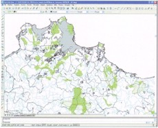 Per mantenere nel tempo la funzionalità del Sistema Informativo Territoriale è necessario che alla fase di creazione ed avvio, ne segua una, non solo di applicazione, ma di aggiornamento e continuo arricchimento della banca dati.
Il tematismo di base del SIT del demanio forestale difetta oggi per una certa vetustà del dato, in parte con riferimento agli elementi quantitativi (superfici), ma soprattutto con riferimento agli elementi legati a dinamiche evolutive (aumento del grado di copertura, fenomeni di latifogliamento naturale) o di degrado (incendi, danni da pascolo) delle formazioni forestali.
Inoltre è mancata in questi anni l'acquisizione sistematica di dati infrastrutturali relativi al territorio forestale (come ad es. la viabilità, fabbricati demaniali, punti acqua, etc.), che, acquisiti dalla bancadati del SIT, potrebbero consentire analisi territoriali più complete per la gestione del patrimonio forestale.
L'aggiornamento e l'incremento dei dati rappresenta un'azione di non facile realizzazione, in relazione all'ampiezza delle superfici gestite, al grado di diversità forestale delle stesse ed alle molteplici attività istituzionali già sostenute dal personale tecnico del DRAFD.
Infine si reputa indispensabile la condivisione del dato forestale a livello regionale, sia con lo scambio diretto (già realizzato con l'Assessorato Regionale Territorio ed Ambiente e con altri Enti territoriali in Regione), sia attraverso pubblicazione sul WEB, affinché sia gli utenti interni che esterni alla pubblica amministrazione, possano accedere allo stesso, nello spirito della condivisa informazione territoriale, che è proprio dei Gis.
Per mantenere nel tempo la funzionalità del Sistema Informativo Territoriale è necessario che alla fase di creazione ed avvio, ne segua una, non solo di applicazione, ma di aggiornamento e continuo arricchimento della banca dati.Il tematismo di base del SIT del demanio forestale difetta oggi per una certa vetustà del dato, in parte con riferimento agli elementi quantitativi (superfici), ma soprattutto con riferimento agli elementi legati a dinamiche evolutive (aumento del grado di copertura, fenomeni di latifogliamento naturale) o di degrado (incendi, danni da pascolo) delle formazioni forestali.
Inoltre è mancata in questi anni l'acquisizione sistematica di dati infrastrutturali relativi al territorio forestale (come ad es. la viabilità, fabbricati demaniali, punti acqua, etc.), che, acquisiti dalla bancadati del SIT, potrebbero consentire analisi territoriali più complete per la gestione del patrimonio forestale.
L'aggiornamento e l'incremento dei dati rappresenta un'azione di non facile realizzazione, in relazione all'ampiezza delle superfici gestite, al grado di diversità forestale delle stesse ed alle molteplici attività istituzionali già sostenute dal personale tecnico del DRAFD.
Infine si reputa indispensabile la condivisione del dato forestale a livello regionale, sia con lo scambio diretto (già realizzato con l'Assessorato Regionale Territorio ed Ambiente e con altri Enti territoriali in Regione), sia attraverso pubblicazione sul WEB, affinché sia gli utenti interni che esterni alla pubblica amministrazione, possano accedere allo stesso, nello spirito della condivisa informazione territoriale, che è proprio dei Gis.
Web Collegati |
Informazioni |
Servizi online |


boschi di sicilia, dipartimento regionale azienda foreste demaniali, azienda foreste, foreste demaniali, riserve naturali siciliane, aree attrezzate siciliane, parchi siciliani, forestale siciliana, rifugi siciliani, boschi siciliani